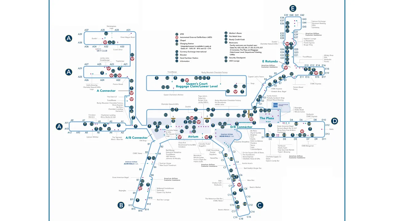
CLT Airport map helps travelers navigate the airport’s various areas and airline facilities. It displays all gates, check-in counters, and baggage claim belts across the two concourses. Available on the airport’s official website, the interactive map also allows passengers to locate amenities and other airport services with ease.
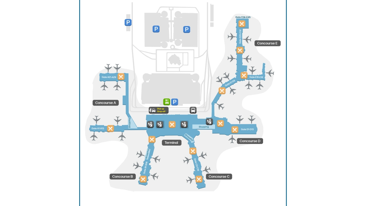
CLT Airport Map
Charlotte Douglas International Airport map provides an overview of the area, marking all essential and accessible spots, including levels on each concourse and baggage claim facilities. Along with other amenities, like dining areas, coffee shops, retail shops, airline counters, parking areas, lounges, ground transportation, and accessibility features.
Charlotte Airport Terminal Map
The CLT Airport map provides that runs on a single terminal building that connects all five concourses for ticketing, baggage claim, and security screening processes. The terminal map showcases four levels named Lower Level, Level 1, Level 2, and Level 3. Lower Level provides walkways, while baggage claim, check-in, and bridges are available on Levels 1, 2, and 3, respectively.
Map of CLT Airport Concourse A
Concourse A at Charlotte Airport has two levels, Levels 2 and 3. Level 2 is specifically for departures, featuring 32 gates. Level 3 offers bridges.
Concourse B Map at Charlotte Airport
Unlike the first concourse, it has only one level, i.e for American Airlines domestic departures through 16 available gates.
Concourse C Map, CLT Airport
Map of CLT Airport Concourse C reflects that it only has level 2 to handle American Airlines domestic departures from CLT Airport via its 18 gates.
Charlotte Douglas Airport Concourse D Map
This concourse map shows two levels, one for departures and the other for bridge access. With 13 gates, it handles all international flights without customs preclearance.
CLT Concourse E Map
Concourse E map displays just one level, i.e for departures of American Eagle and Contour Airlines.
Charlotte Airport Parking Map
CLT Airport parking map offers multiple parking facilities, around 8 lots:
-
Valet Parking
-
Hourly Deck
-
Daily Deck
-
Express Deck Preferred
-
Express Deck Self-Park
-
Long-term lots, 1 and 2
-
Daily North
Rental Car Centre Map CLT Airport
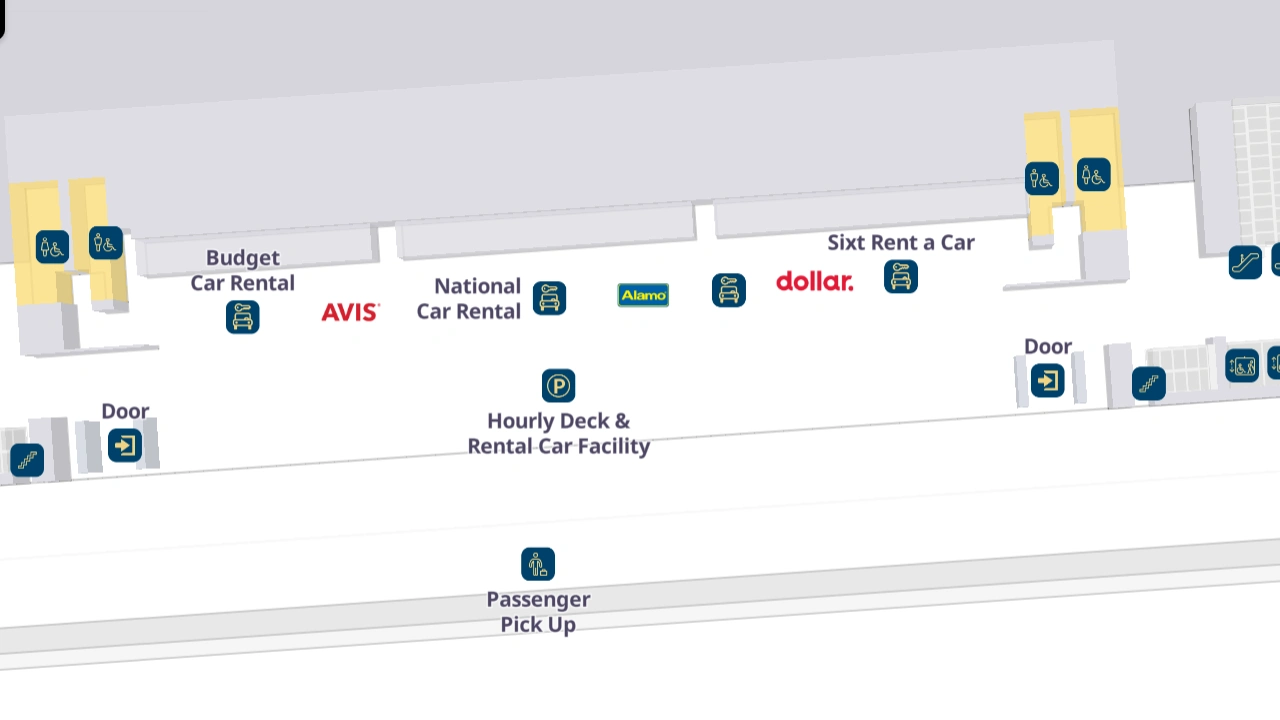
The Charlotte Douglas Airport RCC Map shows two levels: the lower level with walkways, and Level 1 for rental car companies, including:
-
Alamo Car Rental
-
Enterprise Rent-A-Car
-
Avis Car Rental
-
Budget Car Rental
-
Dollar Rental Car
-
Hertz Car Rental
-
National Car Rental
-
Sixt Car Rental
How to Navigate at Charlotte Douglas International Airport
Flyers can make their navigation easy by using the CLT Airport interactive map, where they can search and get directions from their current location.
Charlotte Douglas Airport map highlights the terminal, gate numbers, baggage claim areas, rental car facilities, parking lots, restaurants, the train station, and ground transportation zones. As the airport continues to expand and update, the official map remains the most reliable source for current facility locations and changes.